Preface: In ancient time of South America Tribal leaders would cover their bodies with gold powder and wash themselves in a holy lake in the mountains. For example, the famous place for ancient civilization execute this ceremony is Lake Titicaca. Priests and nobles would throw precious gold and emeralds into the lake dedicated to God.
El Dorado, so called the Golden Kingdom is an ancient legend that first began with a South American ritual. Spanish Conquistadors, upon hearing these tales from the natives, believed there was a place abundant in gold and precious stones and began referring to it as El Dorado. Many explorers believe that Ciudad Blanca is the legendary El Dorado. Legend has it that somewhere beneath the forest canopy lies the ancient city of Ciudad Blanca and now archaeologists think they may have found it.
A group of scientists from fields including archaeology, anthropology and geology using new technology known as airborne light detection and ranging (LiDAR). They found what appears to be a network of plazas and pyramids, hidden for hundreds of years in the underneath of the forest.
Background: What is LiDAR? LiDAR (light detection and ranging) is a remote sensing method that uses a laser to measure distances. Pulses of light are emitted from a laser scanner, and when the pulse hits a target, a portion of its photons are reflected back to the scanner. Because the location of the scanner, the directionality of the pulse, and the time between pulse emission and return are known, the 3D location (XYZ coordinates) from which the pulse reflected is calculable.
Which software is used for LiDAR data processing?
While LiDAR is a technology for making point clouds, not all point clouds are created using LiDAR. For example, point clouds can be made from images obtained from digital cameras, a technique known as photogrammetry. The one difference to remember that distinguishes photogrammetry from LiDAR is RGB. Unlike the RGB image, the LIDAR projection image does not have obvious texture, and it is difficult to find patterns in the projected image.
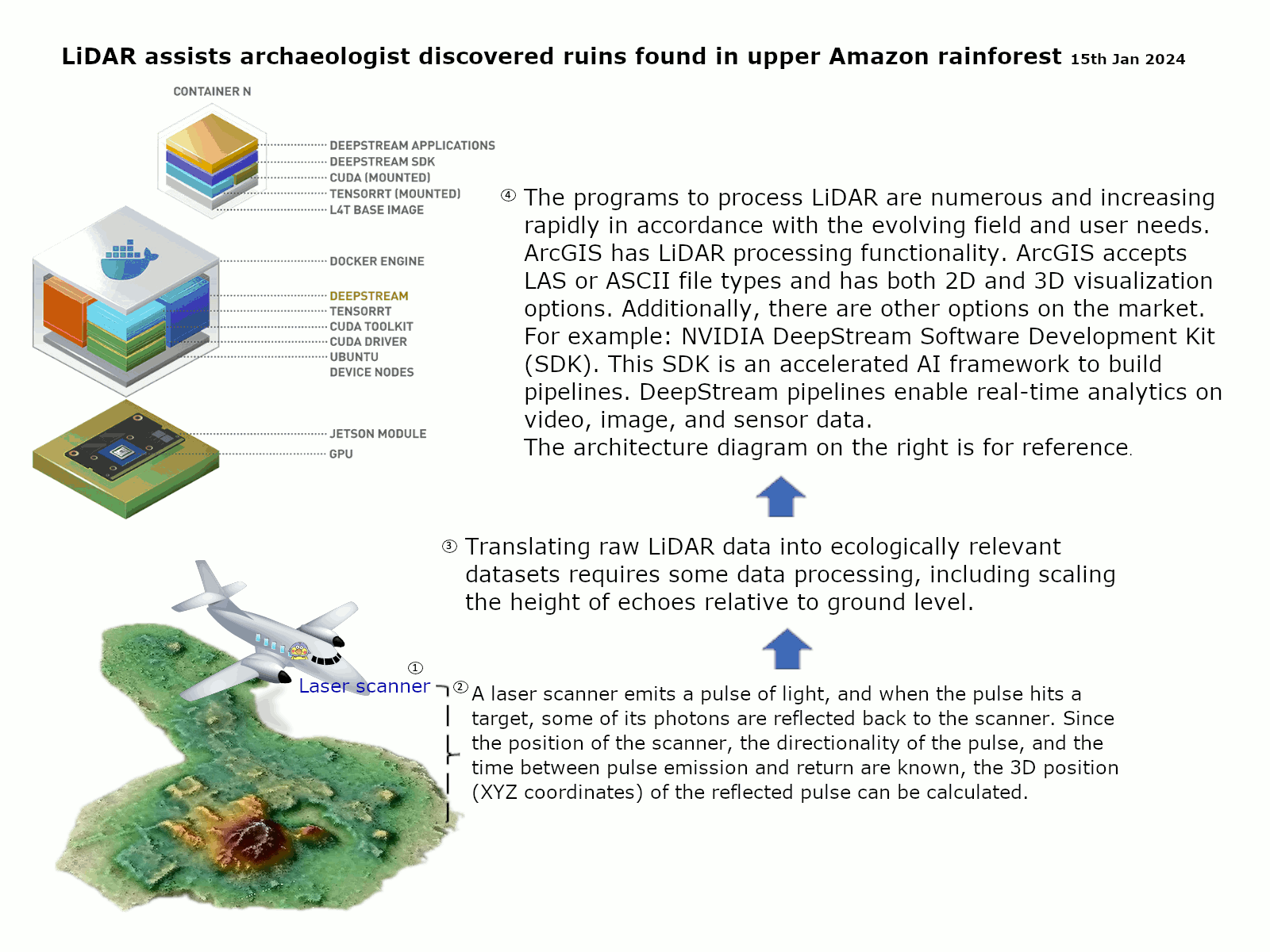
The programs to process LiDAR are numerous and increasing rapidly in accordance with the evolving field and user needs. ArcGIS has LiDAR processing functionality. ArcGIS accepts LAS or ASCII file types and has both 2D and 3D visualization options. Additionally, there are other options on the market. For example: NVIDIA DeepStream Software Development Kit (SDK). This SDK is an accelerated AI framework to build pipelines. DeepStream pipelines enable real-time analytics on video, image, and sensor data.
The architecture diagram on the right is for reference.
Headline News: https://www.sciencenews.org/article/ancient-urban-complex-ecuador-amazon-laser